File:Halo Star Map V2.png
From Halopedia, the Halo wiki
Original file (1,101 × 796 pixels, file size: 101 KB, MIME type: image/png)
| This image is a fan-created representation (vector graphic, diagram, chart, etc.) of a canonical subject, but was not itself produced by the developers of the Halo franchise. |
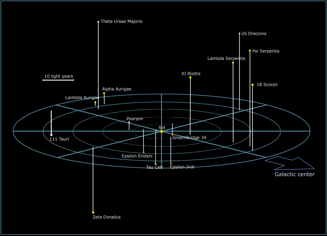
An approximate chart of known, real-world star systems featured in the Halo universe. The stars are colored based on their luminosity, and the vertical lines extending from the stars mark the distance and position of each star relative to an imaginary surface oriented based on Sol's position on the galactic plane.
The map is not an official document, but if the star systems in the Halo universe are situated similarly to their real-world counterparts, it can be considered a rough reference image. The map is based on the star maps at Atlas of the Universe.
Licensing[edit]
File history
Click on a date/time to view the file as it appeared at that time.
| Date/Time | Thumbnail | Dimensions | User | Comment | |
|---|---|---|---|---|---|
| current | 10:07, June 29, 2011 | | 1,101 × 796 (101 KB) | Tacitus (talk | contribs) | |
| 20:12, October 14, 2010 |  | 1,500 × 1,202 (564 KB) | halowikia>Jugus |
You cannot overwrite this file.
File usage
The following page uses this file: